 Stikan Map
User guide
How to use Stikan Map · screenshots from the Icelandic version on iPhone; the app looks the same on Android
Stikan Map is a highland map that keeps everything on your device: maps, place names, search and routing. It works just as well on Sprengisandur or in Þórsmörk, where there is no mobile coverage. Whenever it has a connection, the app fetches the latest road conditions and weather and keeps them with a timestamp.
1. First launch
- Accept the terms. They remind you that the app is a guidance map, not a safety device.
- Download the maps (about 1.3 GB). Use Wi-Fi. If the download is interrupted it resumes the next time you open the app.
- Allow location while the app is open. It is only used on the device and goes nowhere.
When newer map data is released the app asks once whether you want to download it. Only the changed files are fetched.
2. The map and place names
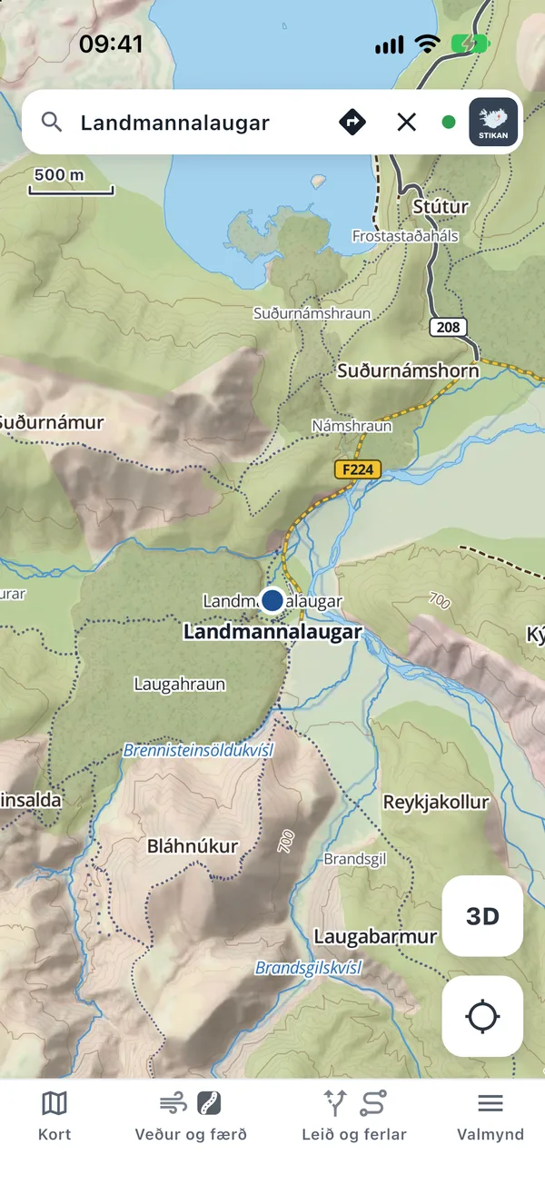
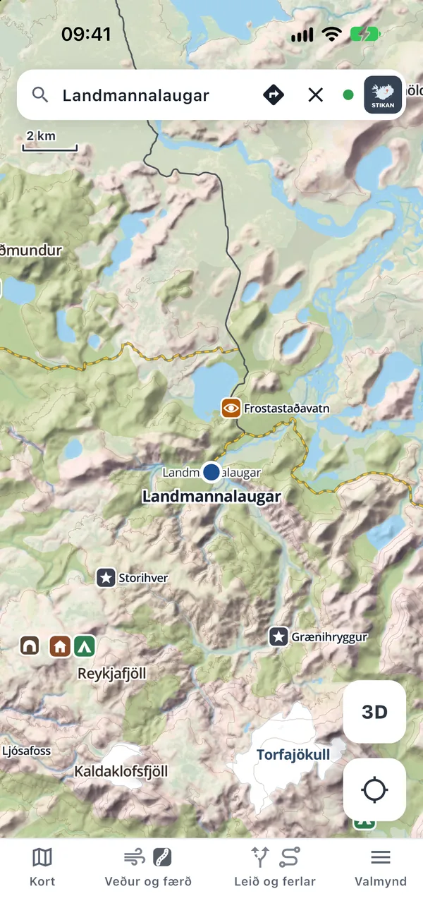
The base map is a topographic map with hillshading and contour lines. Place names come from IS 50V by the National Land Survey of Iceland: thousands of mountains, valleys, rivers, lakes, glaciers and farms, all in Icelandic and all offline.
- Pinch to zoom and drag to move the map.
- Hold your finger on the map for 2 seconds to see the coordinates and elevation of that spot.
- In the Map panel choose Topographic, Street map (for towns) or Weather map.
- Roads are drawn by importance: national roads strongest, then other roads, F-roads, tracks and hiking trails.
3. Offline search
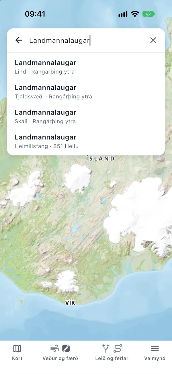
Tap the search field at the top and start typing. Search covers place names, towns, streets, addresses, huts, campsites and attractions, all on the device itself.
- Each result shows its type and municipality, so places with the same name are easy to tell apart.
- Pick a result to fly there. The arrow icon in the search field calculates a route to it.
4. Attractions and layers
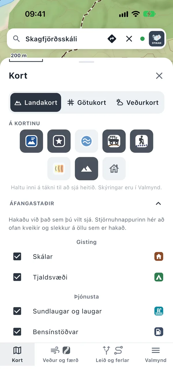
The map has about 1,550 attractions: waterfalls, hot springs, caves, lighthouses, churches, museums and viewpoints, plus huts, campsites, pools, petrol stations and shops. Each category has its own shape and colour, so the symbols can be told apart without relying on colour vision.
- Open Map at the bottom. The star switches all points of interest on or off at once.
- Under Points of interest tick the categories you want to see. Under Place names choose place-name categories.
- Other layers: 4x4 tracks, hiking trails, glacier crevasse areas and 3D buildings.
- Press and hold a symbol in the panel to see what it shows. A legend is also in the Menu.
- Ice caves get a special warning: they change from year to year and can collapse.
5. Weather and road conditions
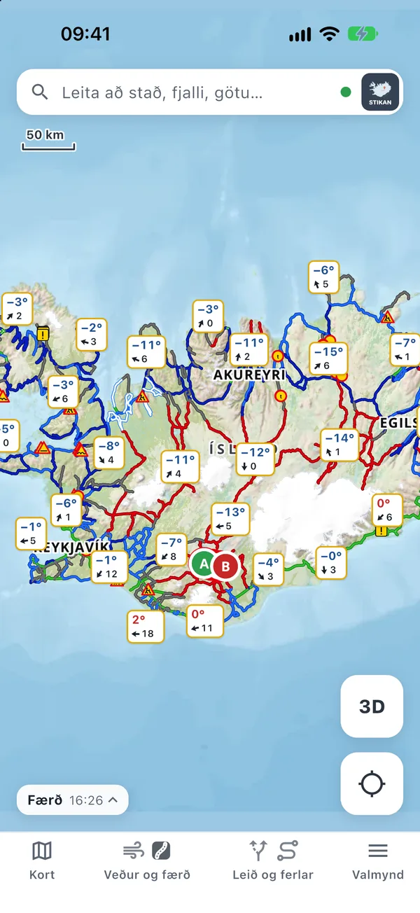
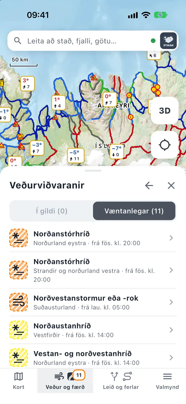
Road conditions from the Icelandic Road Administration and weather from the Icelandic Met Office on one map. Open Weather & roads at the bottom and switch on Weather, Roads and Warnings.
- Weather stations show temperature and wind. Tap a station for observations and a point forecast.
- Roads colours roads by the condition the Road Administration reports, such as ice, impassable and closed, and shows roadworks and incidents.
- Warnings shows yellow, orange and red weather warnings, current and upcoming.
- The weather map shows the Met Office point forecast for the coming days.
Offline, the app shows the last data it received, always with its time, so you know how old it is. Open the app before you lose coverage.
6. Routing: F-roads and fords
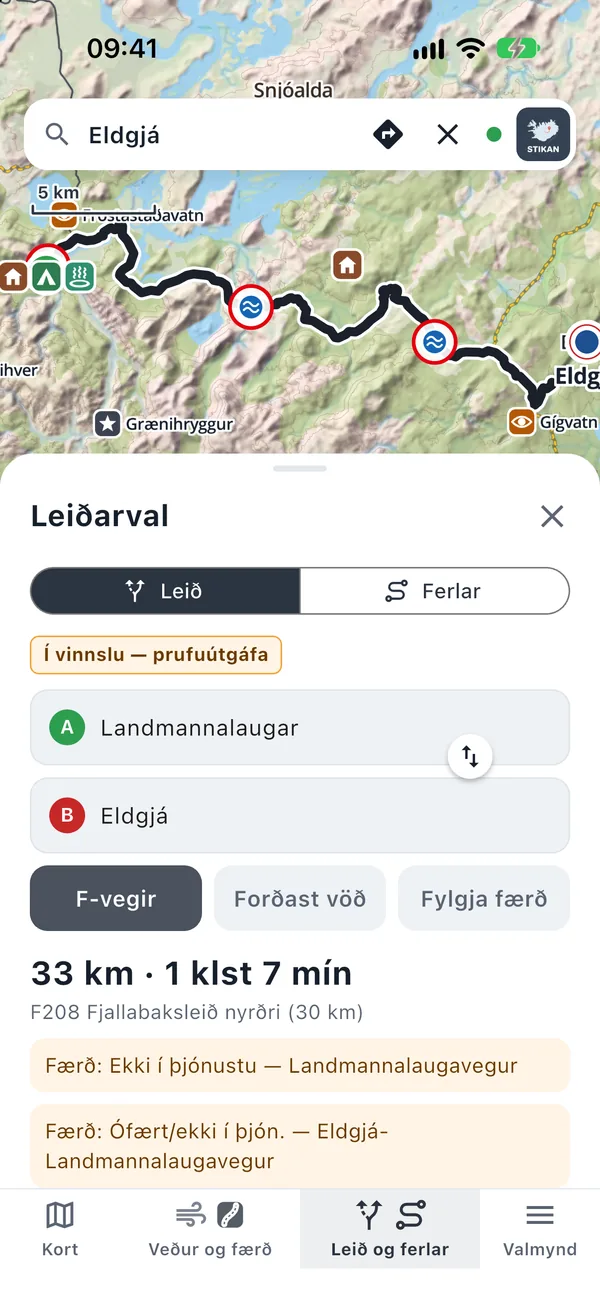
Routes are calculated on the device, offline, with highland conditions in mind:
- F-roads are only used if you switch them on.
- Avoid fords looks for routes around unbridged rivers.
- Avoid closures avoids roads the Road Administration lists as closed or impassable. Switch it off to plan ahead, for example a highland trip in winter.
- Fords are marked on the route and listed by road name, together with conditions on each section.
Open Routes & tracking, choose a start (or your location) and a destination. You can also tap places on the map.
Assess every ford on site. Water levels change with weather, season and time of day.
7. Navigation and tracks
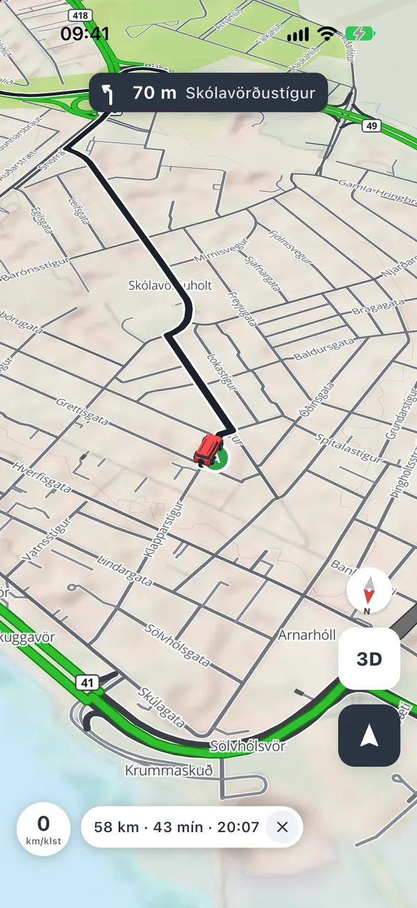
- Start navigation shows a turn banner, speed, arrival time and conditions ahead. There is no voice guidance, so keep the screen where you can see it.
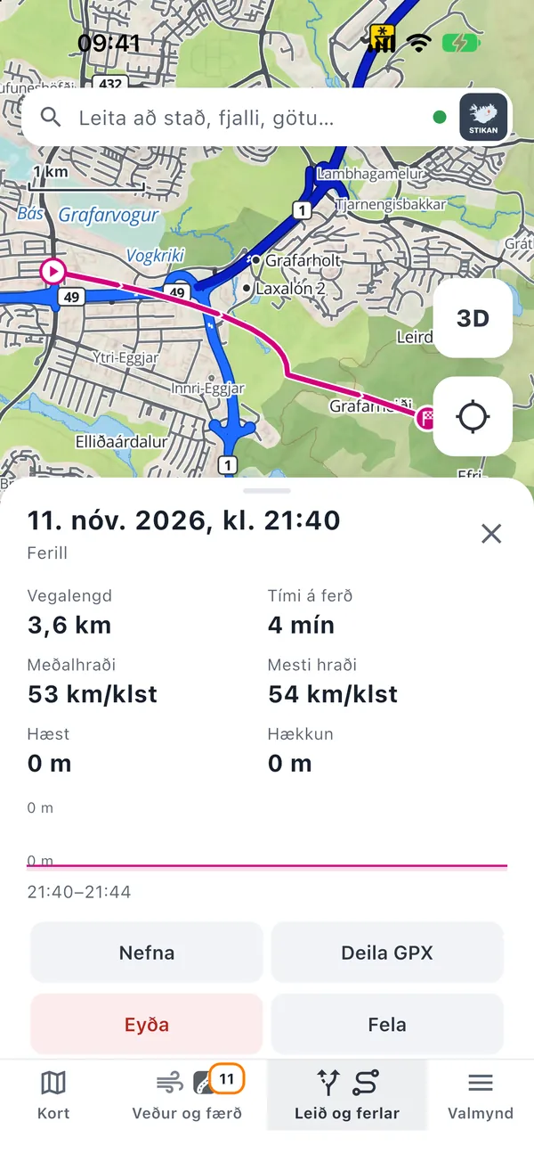
- Tracks: under Tracking you record your trip while the app is open. The track is saved with distance and time and can be shared as a GPX file.
8. 3D
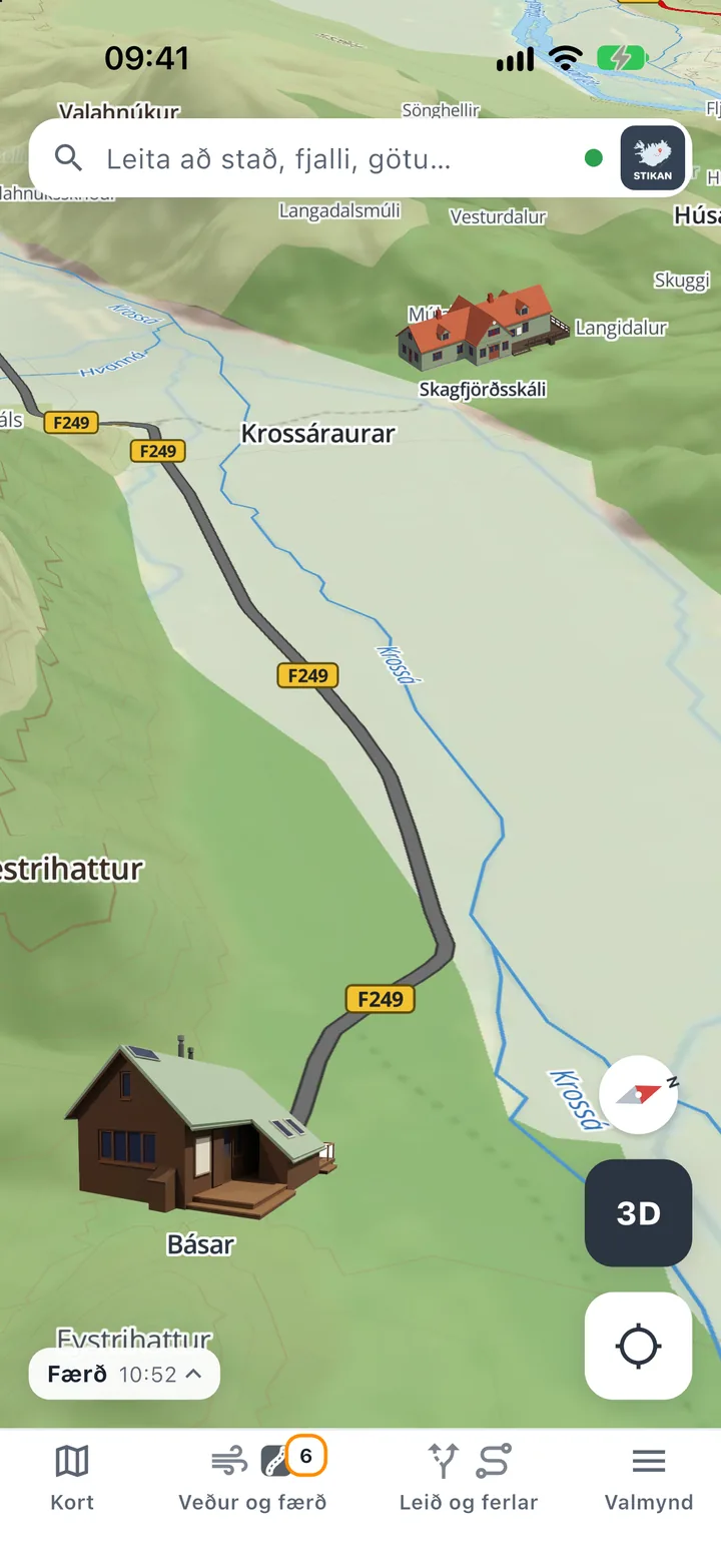
Tap 3D to tilt the map and see the terrain in three dimensions, built from the National Land Survey elevation model. Many mountain huts are drawn as 3D buildings. Tap a hut with a 3D model to see it up close.
3D is still in development and can be heavy on older devices.
9. Emergency
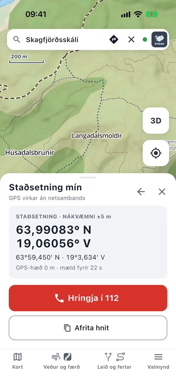
At the top of the Menu is the red button In an emergency: call 112. It opens a panel with:
- Your coordinates in decimal degrees and in degrees and minutes, the way the emergency line and rescue teams ask for them.
- The accuracy and altitude of the GPS fix and how old it is.
- Buttons to call 112 and copy the coordinates, e.g. into a text message.
GPS works without a mobile connection, so the coordinates are correct even with no coverage.
10. Tips for your trip
- Open the app on Wi-Fi or 4G before you set off, so the latest road conditions and weather come with you.
- Plan your route at home and check fords and closures along the way.
- Keep a charger in the car. A map and GPS on screen use battery.
- Check conditions on umferdin.is, vedur.is and safetravel.is, and leave a travel plan.
Stikan Map is not a safety device. The map is for guidance and the data may be wrong or out of date. Always follow signs and closures on site. Off-road driving is illegal in Iceland. See the disclaimer and terms.
Questions or feedback?
In the app: Menu › Send feedback. Or email [email protected].